From the Ouachita Mountains to the Ozarks, Arkansas is home to some of the most beautiful landscapes, featuring rolling hills, verdant woodlands, tranquil lakes, and cascading waterfalls. Hailed as a world-class destination for hiking, boating, and fishing, Arkansas also boasts some spectacular waterfalls with beautiful icons for spring-time swimming to hidden gems for shady summer picnics and relaxing with the family. Here are some of the state’s best known and lesser heard of waterfalls to explore, experience, and enjoy.
Cedar Falls
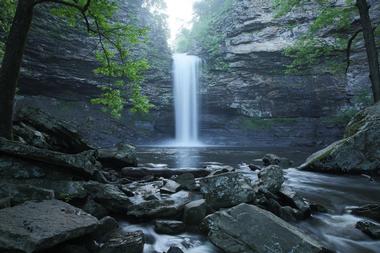
Hailed as one of the most beautiful natural waterfalls in the state, Cedar Falls is situated at the top of Petit Jean Mountain near Morrilton in the heart of Petit Jean State Park.
The 95-foot waterfall cascades into Cedar Creek at a fast rate with a classic rectangular shape, which makes for spectacular “splash-down” views and creating rainbows that rise from the spray. Cedar Falls (Video) can be accessed via the Cedar Falls Trail, which is a 2.25-mile round trip that winds down towards the base of the waterfall and back to the parking lot and is considered to be a moderate to strenuous hike.
A deep and shady grotto along the trail offers lovely views of the waterfalls from a variety of angles.
Petit Jean State Park: 1285 Petit Jean Mountain Rd, Morrilton, AR 72110, Phone: 501-727-5441
Cougar Falls
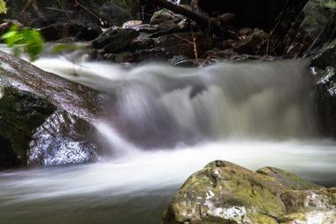
Tucked away in the Ozarks National Forest along a short stretch of road that borders the Leatherwood Wilderness, Cougar Falls is one of four waterfalls in the area that offer excellent hikes and lovely views. Cougar Falls can be reached by traveling down Rand Road for about 1.2 miles and parking on the right-hand side of the road. From the parking spot, bushwhack downhill into the woods and keep following the little drainage to the small creek at the bottom, which will lead you to the top of Cougar Falls after about a third of a mile. The other three waterfalls, namely China Falls, Crosscut Falls, and Little Glory Hole, are a short distance away and can be visited at the same time.
Rand Road, Leatherwood Wilderness, Ozarks National Forest
Dripping Springs Falls - Natural Falls
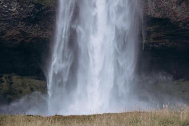
Located in Natural Falls State Park, which is one Oklahoma’s scenic wonders, Dripping Springs Falls, now known as Natural Falls after being renamed to distinguish it from another state park in Oklahoma known as Dripping Springs State Park, is a beautiful 77-foot waterfall just a few miles west of Siloam Springs. The natural setting and scenic beauty of the waterfall made it famous for being site of the 1974 classic American film, Where the Red Fern Grows, which is still evident today with the waterfall plunging over a limestone cliff into a deep V-shaped ravine, which has been carved over thousands of years by the flowing waters of the stream. The bottom of the gorge is an oasis of peace, where rare fauna and flora thrive.
Natural Falls State Park: US Highway 412 West, Colcord, OK 74338, Phone: 918-422-5802
Eden Falls
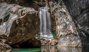
Cascading from towering, moss-lined rocks and boulders into a narrow canyon in Buffalo National River Park (Video), Eden Falls is one of Arkansas' many amazing waterfalls and is at its most spectacular immediately after a shower. Located in Lost Valley near Ponca, home of the stunning Upper Buffalo River, the 35-foot waterfall is easily reached by a short, moderately rated hike along a trailhead that is situated at the end of Lost Valley Road and lined with spring wildflowers and trout lily in season. Park at the end of the road and follow the signed trail to the bluff shelter, where you will find Eden Falls at the far end of the massive overhang. There is cave beneath the overhang that is open to recreational caving and has a hidden waterfall 200m inside the cave.
Buffalo National River Park, 170 Ranger Road, St Joe, AR 72675, Video
Falling Water Falls
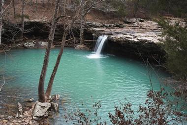
Falling Water Falls is a beautiful little waterfall on Falling Water Creek that spills over into a large pool, which is a favorite swimming hole in the summer. Located south of the Richland Creek Wilderness Area between Russellville and Jasper, the waterfall is literally on the side of the road – a hidden gem located in the middle of nowhere with easy access for a relaxing escape. Falling Water Falls can be found next to Falling Water Road/FR# 1205, just a few miles east of Ben Hur, with plenty of parking on the roadside and a short walk to its base and pool, where you can spend the day picnicking, swimming, and relaxing.
Falling Water Road/FR# 1205, Richland Creek Wilderness Area, AR 72675
Forked Mountain Falls
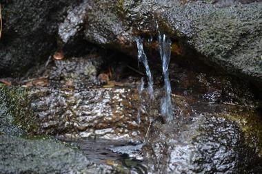
Forked Mountain Falls is one of two scenic waterfalls located in the shadow of Forked Mountain, the other being the Twist Cascade. Situated in the Flatside Wilderness of the Ouachita National Forest, Forked Mountain rises to an elevation of 1,350 feet and is surrounded by spectacular vistas of the Wilderness Area and National Forest. Forked Mountain Falls is easily reached by hiking just under a mile along a trail that begins just past the South Fourche Campground and crosses the creek several times before coming to the base of the waterfalls and the large pool into which it flows. A slightly further hike downstream and across the stream on an old, overgrown road trace will bring you to the second waterfall of Twist Cascade.
Glory Hole Falls
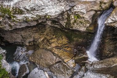
Plunging through a large hole in an overhanging cave bluff into a cavernous cliff grotto below, Glory Hole Falls are truly spectacular immediately after rainfall or during the winter, when they freeze into an ice curtain. Located 6 miles east of Fallsville in the Upper Buffalo Region, the Glory Hole Falls attract beginner adventurers, who come to try their spelunking skills in the cavernous cliff cave 30 feet beneath the falls, which is reached by a relatively easy, non-elevated hike of almost a mile from Highway 16 near Deer. The falls can be viewed from the top of the cliff or from below, which takes an extra short hike to get to the bottom of the 30-foot drop.
Ozone, AR 72854, Phone: 870-757-2211
If you are looking for a great family spot for a photo, check out Triple Falls in Jasper, Arkansas.
Hamilton Falls
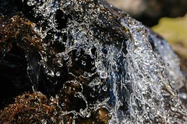
Located in the Big Piney Ranger District in the Ozark National Forest, Hamilton Falls is one of three waterfalls in the Richland Creek Wilderness Area that offer stunning scenic spots after good rains. Situated further up the Big Devil's Creek drainage from the Twin Falls, Hamilton Falls empties into a lovely tranquil pool surrounded by large boulders. A relatively strenuous 6-mile hike reaches the three waterfalls, namely the Richland, Twin, and Hamilton Falls, with a steep elevation that takes between 3 and 4 hours to complete, there and back. During the rainy season, the Ozark National Forest is filled with streams of swiftly flowing water, so be cautious when crossing brooks and creeks.
Hardy Falls
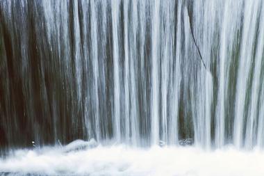
Hardy Falls is best known for its unique and beautiful location rather than for its height. The most impressive view of the waterfalls is through a stone culvert that was designed to form part of the road to the top of Mount Magazine that was built in the 1930s. Designed by an expert named James W. Hardy, the beautifully handcrafted culvert happens to line up with the waterfall to create an awe-inspiring view, hence the waterfall being named after Mr. Hardy. Hardy Falls can be reached by following the road from the visitors center at Mount Magazine State Park for about 6 miles until the signage for the waterfalls can be seen on the roadside.
Mount Magazine State Park: 577 Lodge Drive, Paris, AR 72855, Phone: 479-963-8502
Haw Creek Falls
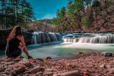
Haw Creek Falls is a wide, shallow waterfall that is only about 5 feet high but boasts an impressive volume of water after rains. Located in the Haw Creek Falls Campground in the Ozark National Forest, Haw Creek Falls is easily accessible by both car and foot with access from the Ozark Highlands Trail or a car park. The area around the falls has several campsites with picnic tables, pedestal grills, and a vault toilet, and they are all close to Big Piney Creek Bridge and Pam’s Grotto. The Haw Creek Falls Campground is a short drive north of Hagarville on Ark and west of Pelsor on Ark and is sometimes temporarily closed due to high water.
Hagarville, AR 72839, Phone: 479-284-3150
Hemmed-In-Hollow Falls
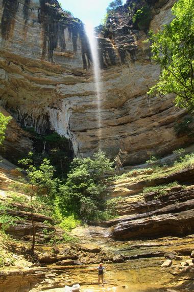
Hemmed-In-Hollow Falls is a single-drop 209-foot waterfall set on the Buffalo National River in the Ponca Wilderness Area in northern Arkansas. Named after the small valley of Hemmed-In-Hollow, which is bordered on three sides by 200-foot bluffs, Hemmed-In-Hollow Falls is the tallest waterfall between the Appalachians and the Rockies and is at its best in late winter or early spring, when heavy rains cause large volumes of water to cascade off the cliff. The falls can be accessed from various hiking trails, including the Centerpoint Trailhead and the Compton Trailhead north of Ponca, which offers the most direct access from State Highway 43. You can also float to the falls from the river trailhead and Kyle's Landing.
Compton, AR 72624
High Bank Twin Falls
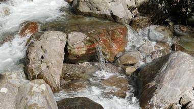
High Bank Twin Falls is a waterfall and hiking trail with the same name, both of which offer beautiful natural scenery and a fun day out. Located off Highway 215 between the towns of Cass and Ozone, this magnificent set of waterfalls is 70 feet tall and flows for the majority of the year from the Mulberry River. High Bank Twin Falls can be reached by a short quarter-mile hike from the highway, which is suitable for all skill levels and dog-friendly. Follow the path from the parking lot across a small stream with natural waterfalls of its own and continue until you arrive at High Bank Twin Falls, which cascades for 70 feet down a massive rock wall. This spot is favorite for hiking and fishing during the fall and winter.
Pleasant Hill, Ozark National Forest, Arkansas Ozarks & Boston Mountains
Kings Bluff Falls
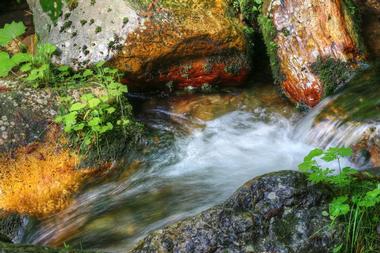
One of the tallest waterfalls in the Ozarks, Kings Bluff Falls pours 114 feet from atop the impressive Kings Bluff, which is situated in the Pedestal Rocks Scenic Area of the Ozarks National Forest. Boasting many spectacular geologic formations and dense woodlands, the Pedestal Rocks Scenic Area offers excellent hiking and natural scenery. King Bluff Falls can be reached by a short hiking trail called the Kings Bluff Loop Trail, which features a few switchbacks and ends at the top of Kings Bluff, where there is a railing. The rocks can be very slippery here, so caution is required, particularly with children.
Pedestal Rocks Scenic Area, Big Piney Ranger District, Ozarks National Forest
Kings River Falls
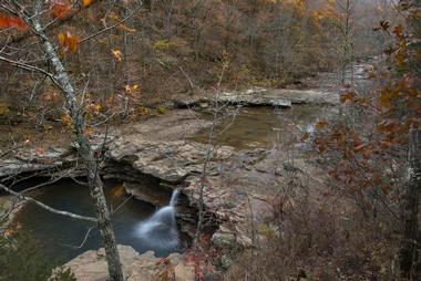
Located in the Kings River Falls Natural Area south of Huntsville, the Kings River Falls is scenic waterfall set on the Kings River, which uniquely flows from south to north. The Kings River Falls Natural Area boasts a variety of diverse landscapes ranging from mixed hardwood forests and scattered pockets of shortleaf pine to sandstone bluffs, steep rocky slopes, and a colorful shrub community. The area features more than 3 miles of the Kings River with the Kings River Falls being a focal point, which is easily accessed by an in-and-out trail that begins and ends at the parking area and runs parallel to Mitchell Creek, a tributary, and the Kings River.
1543 Madison 3500, Witter, AR 72776, Phone: 501-324-9619
Little Missouri Falls
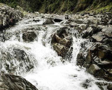
The Little Missouri Falls is a small but scenic cascading waterfall set on the upper reaches of the Little Missouri River deep in the Ouachita National Forest. The stairstep fall flows into a deep gorge, with a spectacular water flow during the winter and spring months and can be reached by an all-weather gravel road and a paved trail leading to observation sites. The day-use area has a picnic site with restrooms at the parking area and access to the Little Missouri Trail, which leads down to the Little Missouri River. The Little Missouri Falls and the surrounding area are excellent for scenic photography.
Hwy 369, Langley, AR 71952, Phone: 870-867-2101
Magnolia Falls
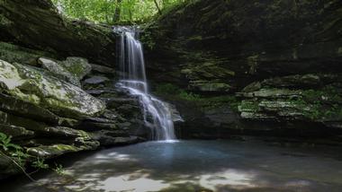
Part of the Upper Buffalo Wilderness in the Ozark National Forest, the little-known Magnolia Falls is a 26-foot tall waterfall that cascades into a little pool of water below. The area around Magnolia Falls is beautifully scenic with high bluffs and large rocks, and the falls are at their best during the spring and winter after substantial rainfall. During the winter, the waterfall ices over, creating spectacular icicle formations. Magnolia Falls is easily accessible by a trailhead, which has easy vehicle access to the trail and a well-defined path that is relatively easy to follow to the waterfalls.
Magnolia Falls, Upper Buffalo Wilderness, Ozark National Forest
Marble Falls
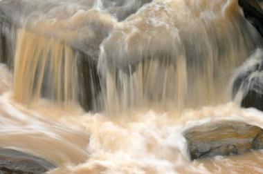
Marble Falls can be found just south of the town of Marble Falls on the Scenic Ark 7 Byway and might be described as a “drive-by” waterfall as it can be seen by just pulling off the road. The waterfall is fed by a spring that once powered a flour mill, cotton gin, and sawmill dating back to 1840, and can be viewed from a pull-in area along the Scenic Ark 7 Byway approximately 2 miles south of Mystic Caverns. A historical stone marker can be found across the highway from the pull-off, which acknowledges the use of Arkansas marble in the construction of the Washington Monument.
Newton County, AR 72601
Mirror Lake Waterfall
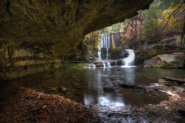
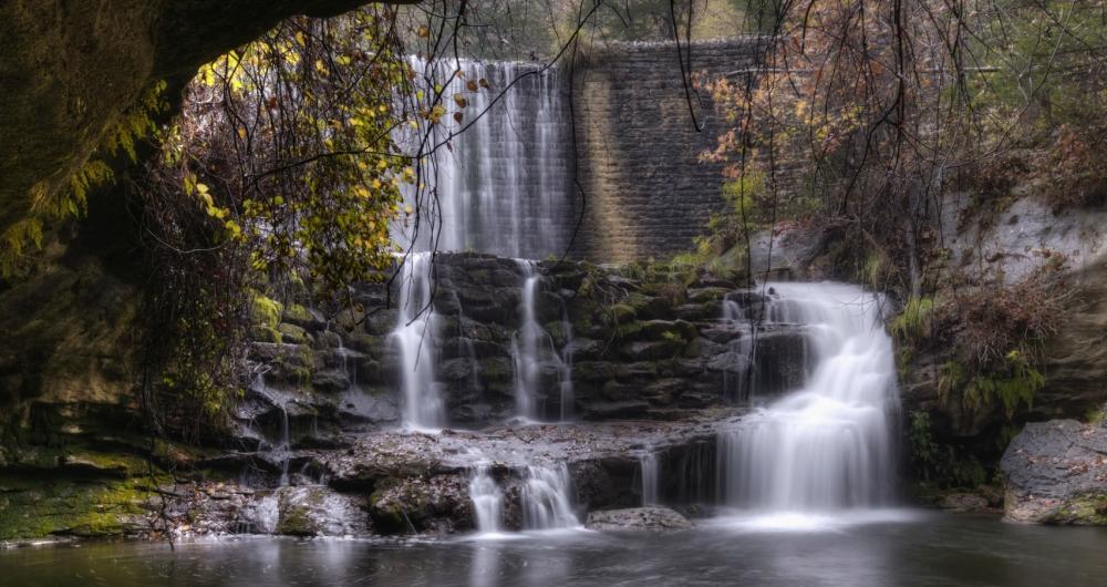
The Mirror Lake Waterfall flows into Mirror Lake, a reservoir created by a concrete and stone dam built by the Civilian Conservation Corps in the 1930s. The 3-acre rainbow trout haven is fed by the Blanchard Springs Cavern, which also supplies the Mirror Lake Waterfall, situated near Mountain View. The beautiful terraced waterfalls can be viewed from the Mirror Lake Trail, which is a 1.7-mile lightly trafficked loop trail that is dog-friendly and offers several year-round activities. The area surrounding Mirror Lake and the Mirror Lake Waterfall features a variety of recreational activities and facilities, including hiking trails, camping sites, picnic areas, and swimming holes, which are popular throughout the summer.
Blanchard Springs Road, Fifty-Six, AR 72533
Mount Magazine Falls
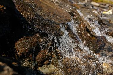
Mount Magazine Falls is one of two waterfalls atop Mount Magazine, the highest point in Arkansas. Mount Magazine Falls can be reached by bushwhacking down the mountain from the Cameron Bluff Overlook Drive to the right of the parking area until you reach the creek that feeds the waterfall. A few hundred yards away is Mount Magazine Falls. The other waterfall on the 2,753-foot Mount Magazine is the Mount Magazine Cascades, which are also easily reached by following a hiking trail, and both offer sweeping vistas of the surrounding river valleys, deep canyons, and distant mountains from the slopes of Mount Magazine. Mount Magazine State Park offers a wealth of outdoor and recreational activities to enjoy throughout the year, ranging from hiking, mountain biking, horseback riding, and rock climbing to rappelling, hang-gliding, and off-road ATV riding.
Mount Magazine State Park: 577 Lodge Dr, Paris, AR 72855, Phone: 479-963-8502
Natural Dam
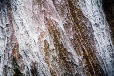
Located on Mountain Fork Creek in the Boston Mountains in the Ozark Mountains, the aptly named Natural Dam is a natural dam in the middle of the creek and one of the most accessible natural waterfalls to visit in the state. Situated approximately 15 miles north of Van Buren, Natural Dam is an all-natural rock wall that spans over 200 feet and covers the entire width of Mountain Fork Creek, which feeds it. The dam and waterfall are set right next to a National Forest picnic site, which has a parking lot very close to the waterfall and offers pleasant picnic sites surrounded by breathtaking scenery.
Ranger District: Boston Mountains, Ozark National Forest
Pam's Grotto Falls
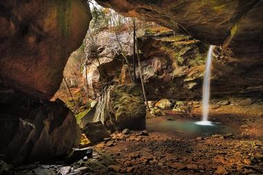
Pam's Grotto Falls is a lesser known waterfall with a 37-foot cascade that drops into a small rock pool at the base with soft, sheltered sounds that will lull you into relaxation. Located about a half-mile hike from the Haw Creek Campground in the Haw Creek Falls Recreation Area in northeast Johnson County, Pam's Grotto Falls features mossy overhangs, edgy boulders, and plenty of privacy and seclusion for a quiet day in nature. The falls are reached by well-traveled trail from the Haw Creek Campground, with plenty of uphill climbing and steep bluffs to navigate before you can enjoy a rocky descent down to the falls.
AR-123, Hagarville, AR 72839
Richland Falls
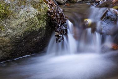
Based where Devil's Fork Creek meets Richland Creek in the heart of the Ozark National Forest, Richland Falls and Twin Falls are two of the state's most beautiful waterfalls. Located in the Big Piney Ranger District in the Ozark National Forest, Richland Falls is one of three waterfalls in the Richland Creek Wilderness Area that offer stunning scenic spots after good rains. In addition to being a secluded gem just off the Ozark Highlands Trail that offers gorgeous waterscapes and natural scenery, Richland Falls is also an incredible place to spend a day climbing trees and swimming the large pool into which the falls drop. Richland Falls are accessed by a 6-mile round-trip hike that includes a fair amount of bushwhacking, water-wading, and steep climbs.
Richland Creek Campground: Campground Rd, Witts Springs, AR 72686, Phone: 479-964-7200
Six Finger Falls
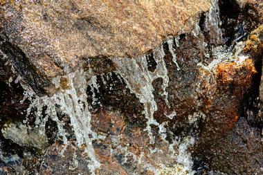
Six Finger Falls is one of five neat waterfalls located along a short length of the road next to Falling Water Creek, just a few miles north of Falling Water Falls. Skirting the edge of the Richland Creek Wilderness Area, which features beautiful natural scenery, dense woodlands, and verdant vegetation, the waterfalls are just a few miles south of the Richland Creek Campground and can be accessed from FR# 1205/CR# 68. The five waterfalls that can be viewed in this area include Fuzzybutt Falls, Keefe Falls, Horsetail Falls, Intersection Falls, and Six Finger Falls.
Richland Creek Campground: Campground Rd, Witts Springs, AR 72686, Phone: 479-964-7200
Twin Falls of Richland Creek

Tucked away in the remote Richland Creek Wilderness Area, the Twin Falls of Richland Creek spans the entire width of Richland Creek and offers spectacular views when the water levels are high. Located in the Big Piney Ranger District in the Ozark National Forest, the Twin Falls of Richland Creek is one of three waterfalls in the Richland Creek Wilderness Area that offer stunning scenic spots after good rains. Situated further up the Big Devil's Creek drainage from the Twin Falls, the Twin Falls of Richland Creek are reached by a hike that requires multiple creek crossings and a bit of a scramble with lots of muddy spots. Prepare to get your feet wet!
Richland Creek Campground: Campground Rd, Witts Springs, AR 72686, Phone: 479-964-7200


