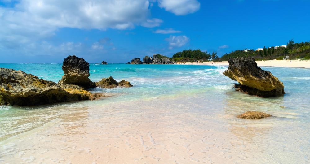
Bermuda is known worldwide for its beautiful expansive pink sand beaches and unique American-British hybrid culture. Visitors can explore miles and miles of coastline on the island, which is home to world-renowned beach sites offering opportunities for swimming, surfing, and barrier reef snorkeling.
Horseshoe Bay Beach
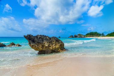
Horseshoe Bay Beach is a beautiful curved beach known for its translucent blue waters and rose-hued sands, created from a combination of crushed coral, shells, and red forminifera deposits. The beach is surrounded by dramatic rock and cliff formations, offering hiking access to spectacular sunset-viewing levels, along with a number of hidden-away coves and caves waiting to be explored by visitors.
Boogie boarding and snorkeling are popular visitor activities at Horseshoe Bay Beach, with beach volleyball areas provided around the shoreline. An enclosed beach area with tranquil waters is also offered for family use. Many area restaurants are located nearby, along with the historic Gibb's Hill Lighthouse, which may be climbed for panoramic views.
West Whale Bay Beach
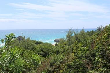
West Whale Bay Beach is one of Bermuda's hidden gems, located along the western edge of Southampton Parish. The beach's name is derived from its proximity to former 18th-century whaling grounds and still attracts a large number of humpback whales, which can be viewed with binoculars from a number of viewing points within the beach or on its surrounding rocky cliffs. Shallow waters provide a safe environment for swimming for young children, with low tide conditions creating opportunities for coral reef wading and exploration. Anglers can also catch pompano, barracuda, and bonefish in the beach's waters. Nearby, the remnants of the 18th-century Whale Bay Fort and Battery are visible, including its troop barracks and underground storage areas. West Whale Bay Beach Map
Warwick Long Bay Beach
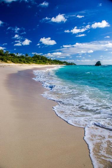
Warwick Long Bay Beach is one of Bermuda's most picturesque beaches, stretching half a mile within Warwick parish's South Shore Park near Horseshoe Bay Beach. The beach has been ranked as one of the world's 100 best beaches and as one of the 10 best beaches in the Caribbean by CNN, offering beautiful stretches of pink sands set against a gorgeous backdrop of cedar and grape trees. Private sunbathing spots are offered, along with great routes for joggers and horseback riders. Shallow snorkeling areas provide opportunities to watch parrotfish feeding along the water's edge, and surprisingly high waves make for great surfing conditions. A children's playground is offered at the park, along with public amenities such as restrooms, showers, and a seasonal concession cart.
Jobson's Cove
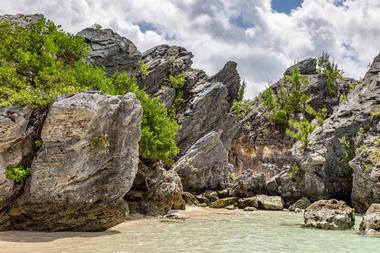
Jobson's Cove is a secluded beach that is a favorite among local residents and tourists alike, located on Bermuda's southern shores near Warwick Long Bay. The beach is named in honor of William Jobson, a 17th-century settler within the region, and is separated from the sea completely by a series of high surrounding cliffs. Pink sands and gentle waves make the beach an ideal hideaway for couples or families with children, with calm wind conditions creating a protected natural swimming and snorkeling area. Ample space is also offered for picnics and sunbathing, with trail provided for walking and horseback riding to nearby Horseshoe Bay Beach. Visitors are advised not to swim near the beach's water source hole to the ocean, as strong currents may cause injuries. Jobson's Cove Map
Tobacco Bay Beach
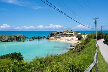
Tobacco Bay Beach is one of Bermuda's most popular public beaches, located within St. George's parish and named for historic tobacco crops that grew in the region. The beach is a perfect spot for snorkeling, offering shallow waters and stunning views of underwater marine life such as angelfishes, blue parrotfish, and walruses. High limestone rock columns separate the bay from the nearby ocean, and as a result, visitors are advised to take caution not to swim through the rocks into the ocean for safety reasons. Public amenities include restrooms, showers, and changing facilities, along with a beachfront bar serving up tropical alcoholic beverages and pub fare. On Friday evenings between May and September, live music performances are showcased at the bar and beach bonfires are held nearby. Tobacco Bay Beach Map
Astwood Cove
Astwood Cove is one of Warwick parish's most lovely and secluded beaches, located near Astwood Park and the city of Hamilton. Though the beach is only accessible via a steep and winding cliff trail, the hike is worth it, as it makes the beach significantly less crowded than other more heavily-touristed area beaches. Visitors can enjoy snorkeling and swimming in the beach's waters, though all swimmers are advised to take precaution in water conditions as no lifeguards are staffed on duty. Birdwatchers can observe white-tailed tropical birds in the sky and get an up-close look at bird nests on the surrounding cliffs. The beach is also one of Bermuda's most romantic areas, serving as a popular wedding site throughout the year. <
Address: a class="map1" href="https://www.google.com/maps/place/Astwood+Park/@32.2624681,-64.8028779,17z/data=!3m1!4b1!4m6!3m5!1s0x8a2d15d26a8c9ae5:0xfe7b6b99c749baf0!8m2!3d32.2624681!4d-64.800303!16s%2Fg%2F1tl1jybq" target="_blank">Astwood Cove, 49 South Road, Warwick, Bermuda
Church Bay
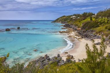
Church Bay is a favorite spot in Bermuda for snorkeling, located in Southampton parish near Church Bay Park and Church Road. The small beach is located at the bottom of a staircase pathway and is covered in beautiful pink sands, with many nooks and crannies along rocky inlet areas throughout the shoreline. Cup and boiler reefs dot the beach's coastline, located as close as 50 meters from the water's edge, and are populated by tropical fish species such as parrotfish, angelfish, and butterfly fish. Visitors should note that water depth spikes quickly off the beach's coast, meaning that children should not be allowed to wade or swim without supervision. During times of high tide, the beach can become completely covered by water. Church Bay Map
Clarence Cove
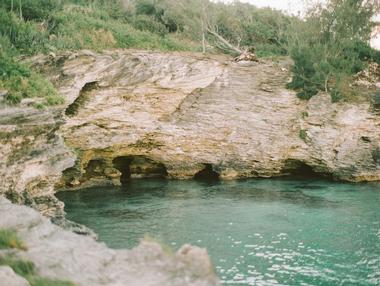
Clarence Cove is a small beach near Hamilton City on Bermuda's northern shore, located at Spanish Point Road near Admiralty House. The beach is named in honor of the Duke of Clarence and is a great spot for snorkeling, populated by unique underwater caves that are home to lobsters, turtles, and other marine life. Pink sands stretch along the beach's southern shore, which may be explored with scooters. Shady trees provide a respite from heat for picnics, and trails offer access to nearby Spanish Point Park and Deep Bay. Visitors can explore the beach daily between sunrise and sunset, with no admission fee charged. Clarence Cove Map
Elbow Beach
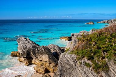
Elbow Beach is one of Bermuda's southern shore's most beautiful pink sand beaches, located in Paget parish near the Coral Beach and Tennis Club and the Elbow Beach Resort. The gently-curving beach is jointly owned by the resort and under public operation, with certain areas accessible to area visitors not staying at the hotel. Due to offshore coral reefs that act as barriers, the beach's water conditions are ideal for swimming. Snorkelers and boat tour participants can also explore the Pollockshields shipwreck, which is located approximately 100 yards off the beach's shores. Pickup beach volleyball games are popular among local residents during the evening hours, with many restaurants and food stands offering refreshments nearby. Elbow Beach Map
John Smith's Bay
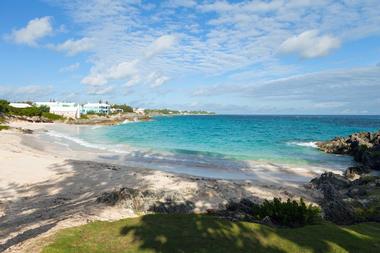
John Smith's Bay is an expansive, secluded beach within Bermuda's Smith's parish near the Devil's Hole Aquarium and the Pink Beach Club, named after famed explorer Captain John Smith, who mapped the region in 1631. The beach is a favorite family recreation spot on Bermuda's southern shores, offering plenty of public facilities, including public restrooms and lunch wagons selling ice cream, burgers, soft drinks, and other refreshments. Snorkeling less than 200 yards off the beach's coastline provides opportunities to watch native marine life, and night diving opportunities offer a unique chance to view the Caribbean by moonlight. Nearby attractions include Spittal Pond Nature Reserve, which is a prime birdwatching location along the island's southern shoreline. John Smith's Bay Map
Clearwater Beach
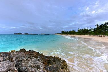
Clearwater Beach is a manmade beach that was created in the mid-2oth century to facilitate the construction of a nearby United States Naval Air Station, which operated until the mid-1990s. The beach is a popular tourist destination during times cruise ships are in port, located along the northern coast of Bermuda's Cooper's Island. Calm water conditions make the beach a prime spot for families, with 12 acres of land surrounding the beach available for use for picnics and recreational activities. Swimming and snorkeling area popular water activities, though no reefs are located off the beach's coastline. Near the beach, visitors can dine at Gombeys Bar and Restaurant. Other attractions include a rollerblading rink and the nearby Turtle Bay Beach, which offers opportunities to feed area marine life. Clearwater Beach Map
Shelly Bay Beach
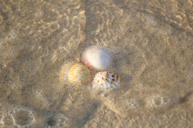
Shelly Bay Beach is Bermuda's number-one beach for visiting families, offering extensive areas of shallow, tranquil waters. The beach, which is located in Hamilton parish, is named in honor of Henry Shelly, a crew member aboard the 1609 shipwreck Sea Venture, which brought the first European settlers to the island. Soft white sands stretch across the beach's shoreline, which is shaded by native trees. Calm water conditions make for an ideal environment for novice swimmers, with coastline features offered such as a mangrove tidal pool and a public wooden boardwalk. Nearby, a free public park offers children's playground equipment, while the island's Railway Museum is accessible via a short half-mile trek. Shelly Bay Beach Map
Daniels Head Beach Park
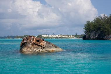
Daniels Head Beach Park is a beautiful beach located in a remote region of Bermuda's Sandy's parish, one of nine beaches within the 17-acre Daniel's Head peninsula that were formerly developed as a World War II-era Canadian Forces Station. As the peninsula's only public beach facility, the beach is accessible via Cambridge Road or off the island's bus #7 and #8 routes. Clear blue waters offer opportunities for swimming and wading for families with children, with snorkeling areas provide opportunities to see angelfish, parrotfish, and wrasse. Approximately 400 miles offshore, visitors can also observe remnants of the shipwreck of the MVS Vixen, which may be explored as part of snorkeling boat tours. Visitors should note that since 2016's Hurricane Nicole, all small business vendors have been removed from the area, but public restrooms and other amenities remain.
Address: Daniels Head Beach Park, Scotts Hill, Bermuda, Phone: 441-705-1111
Hog Bay Beach
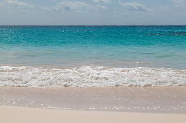
Hog Bay Beach is one of Bermuda's best-kept secrets, located in Sandy's parish and accessible via a wooded trail from nearby Hog Bay Park. The beach is only accessible for about four hours a day during low tide conditions, as it disappears completely underwater during high tide times. Visitors can walk through beautiful cherry and spice tree forest regions along the beach's access trail, which passes an old kiln facility and a number of agricultural field areas. Prime snorkeling conditions are accessible at the beach, which spans 300 meters atlow time. Visitors are advised to check tide charts prior to trips to ensure safe access in and out of the beach. Hog Bay Beach Map
Chaplin Bay Beach
Chaplin Bay Beach is a secluded cove beach located near Horseshoe Bay Beach, straddling the border between Southampton and Warwick parishes. The beach, which is named for British settler Edward Chaplin, is surrounded by high cliffs and is located within South Shore Park, accessible via a 1.25-mile sandy trail connecting the beach to Horseshoe Bay and Warwick Long Bay Beaches. It is a popular spot for visitors on Canada Day, with official Association of Canadians in Bermuda festivities held at the site each year. Swimming conditions are safe near the shore despite rough water conditions offshore, with a beautiful coral barrier reef spanning along the water's edge. Visitors should note that the beach disappears almost completely during high tide times and should plan visits accordingly. Chaplin Bay Beach Map
Stonehole Bay Beach
Stonehole Bay Beach is the twin beach of nearby Chaplin Bay Beach, offering a secluded respite from tourist crowds at nearby Horseshoe Bay Beach. The beautiful pink beach is located within a small cove area and is named for a famous hole within its surrounding rocky cliffs. It is open to the public every day between sunrise and sunset, accessible via a sandy cliff trail from Horseshoe Bay that offers stunning panoramic views of the region's coastline. Though water conditions can be rough at times, most days offer good swimming conditions. Visitors should note that the beach can be difficult to access at high tide times and can even be partially covered by water. Public restrooms are offered nearby, and visitors are permitted to use facilities at nearby beaches. Stonehole Bay Beach Map
Building Bay Beach
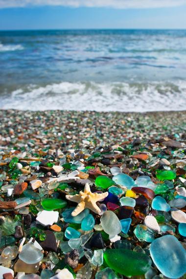
Building Bay Beach is a lovely beach located along Bermuda's eastern edge in St. George's parish, housing the historic Alexandra Battery fortification, which was constructed in the 1860s. The fort was named in honor of Denmark's Princess Alexandra and is open to the public as an historic site, with scenic views offered atop steps at its six-inch rifled breech loader emplacements. The nearby beach is known for its beautiful colored sea glass, providing ample opportunity for beachcombing for unique pieces. Visitors should note that there are no public amenities at the free-admission beach or the nearby fort, which are accessible to the public during daylight hours.
Bailey's Bay and Coney Island

Bailey's Bay and Coney Island are beautiful beachfront sites along Bermuda's northern shore, accessible via Hamilton parish's Railway Trail at Shelly Bay. The residential Bailey's Bay neighborhood of Crawl is home to art galleries and small businesses, surrounded by beautiful farmland landscapes. A 740-foot footbridge connects the bay to Coney Island, which is home to the site of Bermuda's first ferry, opened for operation in the 17th century. Parkland and coastal beach areas abound, with remains from the 20th-century Bermuda Railway Tracks still visible at sites. Visitors can also dine at several restaurants on the island, including the famed Swizzle Inn pub and the Jamaican Grill restaurant, which serves up a variety of West Indian favorites. Bailey's Bay and Coney Island Map


