Whether you are planning a quick weekend getaway or a longer vacation, Arizona is home to some of the most scenic places in the United States. Several Arizona attractions in Arizona that made our list are world-famous, such as the Grand Canyon, Cathedral Rock, Barringer Meteorite Crater and Havasu Falls, while other things to see in Arizona are still relatively undiscovered. Here are the best places to visit in Arizona.
Cathedral Rock, Sedona
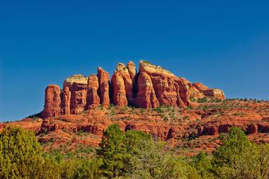
Cathedral Rock in Sedona is one of the most famous landmarks in the U.S. and one of the best places to visit in Arizona. It is located in Yavapai County in the Coconino National Forest, a great place for a day trip. The rock is carved from red sandstone created from sand dunes around the ancient Pedregosa Sea.
The elevation of Cathedral Rock’s summit is 4,921 feet, and reaching that summit is the goal of thousands of hikers every year. Named Cathedral Rock Trail, the steep, short ascent starts at the Back O' Beyond trailhead and climbs all the way to the gaps or saddle points in Cathedral Rock. This challenging but popular trail offers more of a rock climb than a hike. It is not shaded and is very difficult and steep in places.
It takes 1.5 miles to get to the summit and back the same way, and the spectacular views all along the way (especially at the top) make the effort worthwhile. If you are looking for top attractions in Arizona, don't miss this unique destination.
Saguaro National Park
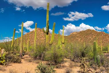
The giant saguaro, a well-known symbol of the American West, grows in very few places in the United States, and Saguaro National Park near Tucson was created to protect these rare and magnificent plants.
Grand Canyon, Arizona
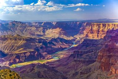
The Grand Canyon is an enormous crack in the Earth that can be seen from space, and visiting this magnificent natural formation is on almost everyone’s wish list. The canyon is the result of millions of years of erosion by the waters of the mighty Colorado River. You can see layers of red rock bands that show its long history on the walls of the canyon. The South Rim of the Grand Canyon is about an hour and a half from Flagstaff.
The canyon is 277 miles long, a mile deep and up to 18 miles wide. Its vast scale and magnificent colors attract millions of visitors every year.
The majority of tourists enjoy the canyon from its south rim, but more adventurous visitors hike its walls, take mule rides, or enjoy thrilling white-water rafting on the Colorado River. Most of the canyon is located within Grand Canyon National Park.
While some parts of the canyon on the upper plateau are covered with forests, most of the area is arid. Nevertheless, it is home to 1,500 plants, 89 mammalians, 355 birds, 9 amphibians, 47 reptiles, and 17 fish speciess.
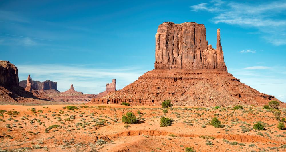
Antelope Canyon, Monument Valley
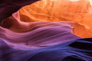
Located on Native American Navajo land east of Page, Antelope Canyon, Monument Valley is made up of two slot canyons: a slot canyon is a deep and narrow canyon formed by water running through several kinds of rocks including basalt, granite, limestone, and sandstone.
Bisbee
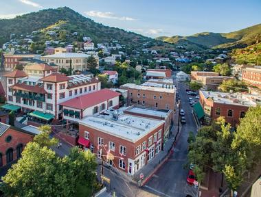
Bisbee, with a population of less than 6,000, is today a popular tourist destination because of its magnificent surrounding red rocks, its colorful history and even more colorful inhabitants. The town is full of galleries, museums, new age shops, restaurants, hotels, and tour guides.
Organ Pipe Cactus National Monument, Arizona
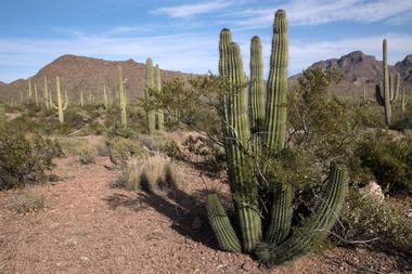
Organ Pipe Cactus National Monument was created in 1937 to preserve one of the few natural habitats of the Organ Pipe Cactus, along with other rare and amazing animals, plants, history, and geology of the Sonoran Desert. This 517 square mile park is full of trails and scenic paths and drives, providing a magnificent destination for days of adventures, camping under the star-lit skies, and exploring the surprisingly alive desert. There are excellent, informative ranger-guided tours that last from half days to several days.
The unique habitat of Organ Pipe Cactus National Monument has an amazing collection of desert animals and plants; 26 species of cactus thrive in this arid area, the most famous of them being the Organ Pipe Cactus and giant Saguaros. Organ Pipe Cactus National Monument is located about two hours from Phoenix.
Barringer Crater, Arizona
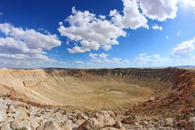
Barringer Crater is a meteor crater near Winslow, Arizona, a popular tourist destination, and the source of endless speculations about the origin of this perfectly round giant hole in the ground. The first person to venture a guess that the hole was created by an impact from a meteor was Daniel Barringer, who gave it the name and whose family also owns the crater and the surrounding land. The big hole is 4,100 feet in diameter and 570 feet deep. It was created about 50,000 years ago by an asteroid about 130 feet wide. Scientists believe that the asteroid was a part of a larger asteroid that broke apart while passing through the atmosphere.
Barringer and other researchers found pieces of this space rock made of iron weighing from one to 1,000 pounds in a six-mile-diameter area around the crater. The latest theory is that the remaining rock hit the Earth at about 26,800 mph, creating the popular Arizona crater. Barringer Crater is one of the must see places in Arizona.
Montezuma Castle National Monument
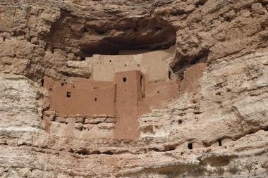
Montezuma Castle is an awe-inspiring National Monument about 50 miles from Flagstaff, which tells the story of the intelligence, ingenuity, and resilience of people who built it thousands of years ago. It is a five-story dwelling cut into the soft limestone cliffs of Beaver Creek Canyon that is located 100 feet above the canyon floor. The castle consists of twenty very well preserved rooms built by fieldstone glued together by mud and clay mortar. Montezuma Castle National Monument is one of the top things to do in Arizona.
Montezuma Castle was probably built and occupied some time during the period between 1200 and 1450 AD at a time when there was an influx of Sinagua people from the north into the region. The name Montezuma Castle came from white settlers who believed that the ruins belonged to Aztecs – Montezuma was one of Aztec rulers.
Lake Powell, AZ
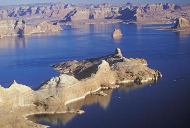
Lake Powell is a man-made reservoir on the Colorado River located on the border between Arizona and Utah. It was created when construction of the Glen Canyon Dam caused flooding of the Glen Canyon in 1972 and is one of the top Arizona destinations. The lake and the area around it are established as the Glen Canyon National Recreation Area, today a very popular summer tourist destination. The reservoir got its name in honor of John Wesley Powell who explored the river in 1869 in wooden boats. Lake Powell also serves as water storage for Colorado, Wyoming, Utah, and New Mexico, the Upper Basin states of the Colorado River Compact. The Compact obliges them to provide minimum of 7,500,000 feet of water annually to the Lower Basin states Arizona, California and Nevada. The lake offers many activities for tourists, including fishing, boating, jet skiing, waterskiing, romantic walks, and hiking. Video, website
Havasu Falls, AZ
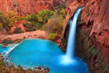
Located close to the isolated village of Supai, the capital of the Havasupai Indian Reservation, Havasu Falls is a waterfall of the Havasu Creek which flows through the Havasupai land in the Havasu Canyon, a part of the Grand Canyon. If you are looking for waterfalls in Arizona to visit on vacation, this place is amazing.
Hoover Dam
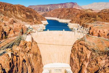
Hoover Dam is a concrete dam located in the Black Canyon of the Colorado River between Arizona and Nevada. Once known as Boulder Dam, it was built between 1931 and 1936 during the Great Depression, and was the largest dam at the time it was built. Thousands of men worked and more than one hundred people died during its construction.
It was built to control the Colorado River as well as provide hydroelectric power. After the dam was completed, water from the area began to collect and Lake Mead was created: this is the largest reservoir in the U.S. Visitors can take tours of the dam and of the power plant.
Superstition Mountains
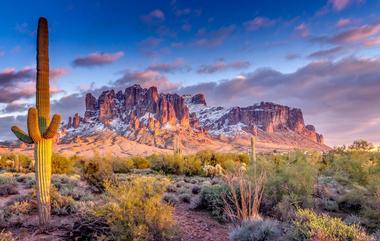
Superstition Mountains are a spectacular mountain range east of Phoenix in Arizona. From a distance, the ghostly 2000-foot high red cliffs look forbidding and inhospitable. However, they offer a range of adventures from hiking the challenging but scenic trails through the Superstition Mountain Wilderness Area and searching for the Lost Dutchman’s Goldmine to spotting bobcats, coyotes, black bears or mountain lions in their habitats.
There is also an abandoned ghost town and the museum that tells the story of the Native Americans and white prospectors who came to the mountains in search of gold more than 100 years ago. If you get tired of roughing it, you can stay at the Gold Canyon Golf Resort at the foot of the mountain with the cool pool and cooler Margaritas.
Tumacacori National Historical Park, Arizona
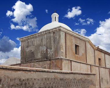
Tumacacori National Historical Park was created to protect and showcase the ruins of three 17th-century missions, the most famous of which is the Mission San José de Tumacácori, established in 1691. The ruins are adobe, wood, and plaster reminders of the clash of cultures and constant changes that swept through this region throughout the last several centuries.
Horseshoe Bend, Glen Canyon National Recreation Area
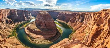
Glen Canyon National Recreation Area stretches from the Orange Cliffs of southern Utah to Lees Ferry in Arizona. This 1.25 million-acre park includes spectacular scenic vistas, magnificent geologic formations, and a colorful and often dramatic human history. One of the many destinations for the adventurous is the Horseshoe Bend, a horseshoe-shaped bend that the Colorado River forms as it meanders around the town of Page, about five miles from Lake Powel and the Glen Canyon Dam. The best way to see Horseshoe Bend is from the high cliff above the river, which can be reached by a mile and half hike from U.S. Route 89. It is a one thousand-foot drop to the river from the overlook.
The Wave
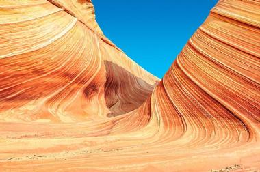
The Wave is a sandstone formation with brilliant, undulating, colorful layers resembling waves. It is located close to the border between Arizona and Utah on the steep slopes of the Coyote Buttes and it is one of the top Arizona tourist attractions.
The Wave is very popular among photographers as well as hikers who love the challenging, rugged, trail-less hike they have to brave in order to reach their destination. The Wave consists of U-shaped troughs formed by erosion of Navajo Sandstone during the Jurassic period.
The Wave is part of the Paria Canyon - Vermilion Cliffs Wilderness. It is not easy to reach Coyote Buttes, so its spectacular scenery, colorful history, and desert wildlife are not disturbed by human impact. Tourists wishing to visit the Coyote Buttes require a permit, which are limited in number.
Paria Canyon-Vermilion Cliffs Wilderness
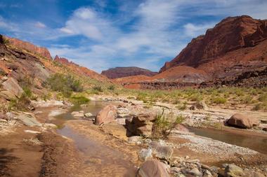
Located in northern Arizona and southern Utah, the Paria Canyon- Vermilion Cliffs Wilderness (Video) is a large area of canyons, cliffs, and plateaus. Covering 112,500 acres the wilderness lies in the dry Colorado Plateau area of Arizona’s Coconino County and Utah’s Kane County.
The area is known for the amazing beauty of its red streaked rocks cliffs, especially the 3,000 foot high Vermilion Cliffs, its sandstone arches, and its wildlife.
Backpacking, camping, hiking, RV parks, and photography are the most popular activities here, and visitors are often able to see the beavers, bobcats, coyotes, deer, fox, mountain lions, and bighorn sheep that live in the area. The Wave on the slopes of the Coyote Buttes is one of the most popular places to visit.
Papago Park
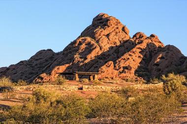
Papago Park is a city park in Phoenix and Tempe, Arizona. Consisting of 1,200 acres in Phoenix and 296 acres is Tempe, the park is a hilly area known for its red sandstone formations, its giant saguaro cacti and other desert plants, small lakes, biking paths, hiking trails, and much more. The Hole-in-the-Rock is a well-known landmark that was possibly used by early Native Americans to follow the annual solstices. Hunt’s tomb is found in the park: built in 1931, former Governor Hunt and his family members are buried here: it is listed on the National Register of Historic Places. There are also baseball fields, the Desert Botanical Garden, and the Phoenix Zoo.
Glen Canyon Dam and Bridge, Arizona
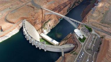
Located near Page, Arizona, Glen Canyon Dam is a large dam built between 1956 and 1966 on the Colorado River. Lake Powell was the result of the dam, but it took 17 years for the lake to completely fill. The dam regulates the flow of the river and also provides energy with its eight hydroelectric generators.
When the Glen Canyon Dam Bridge was completed in 1959 it was the highest arch bridge in the world: it is adjacent to the dam and is a steel arch bridge across the Colorado River. Visitors can take tours of the dam: these tours start at the Carl B. Hayden Visitor Center.
Tonto National Monument - 2 hour 20 minute Weekend Getaway from Phoenix
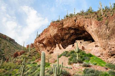
Tonto National Monument is an area in the Superstition Mountains, Gila Country, in central Arizona just on the northeastern border of the Sonoran Desert. The monument is famous for its two Salado culture cliff dwellings. The Salado people lived here from the 13th to the 15th century AD: in addition to the dwellings there are artifacts such as brightly colored pottery and woven cotton cloth.
This part of Arizona is extremely dry: the Salt River runs through here and provides a source of water all year long. In addition to hunting, the Salado people gathered local plants and also farmed.
Plants include several kinds of cacti, agave, palo verde, and yucca.
Spur Cross Ranch Conservation Area
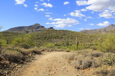
Located in Cave Creek, Spur Cross Ranch Conservation Area is a part of the Maricopa County Regional Parks System. Consisting of 2,154 acres of Sonoran Desert, the park contains green areas along Cave Creek as well as important archaeological sites.
The park gets its name from the fact that there was mining and ranching in earlier days, and evidence of this can still be seen.
One of the most popular things about this park is its incredible variety of wildflowers which pop up in the spring. Within the park there are biking paths, hiking trails, horseback riding, and camping. Stargazing in the clear Arizona sky is also a popular activity.
Canyon De Chelly National Monument
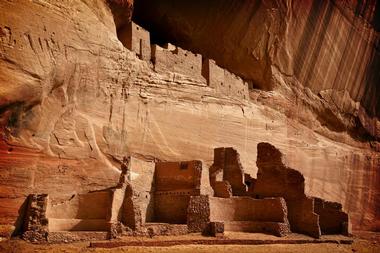
Canyon De Chelly National Monument is an 83,840 acre area that is one of the longest continuously inhabited places in North America: people have lived here for almost 5,000 years. Located within the boundaries of the Navajo Nation, it was established as a part of the National Park Service in 1931 although none of the land is owned by the U.S. Federal Government.
The area is dually managed by the Navajo people and the National Park Service. There are ruins here of the Anasazi, or Ancient Pueblo Peoples, as well as the Navajo people. The monument is made up of three canyons including their rims and floors: the de Chelly, the del Muerto, and the Monument.
Petrified Forest National Park, Arizona
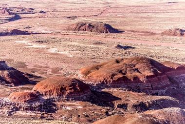
Located in Apache and Navajo counties in northeastern Arizona, Petrified Forest National Park gets its name from the large amounts of petrified wood, covering an area of about 146 square miles (380 square kilometers). The terrain is dramatic with its colorful and eroded badlands and its semi-desert environment.
The park was made a national monument in 1906 and a national park in 1962. It is a popular park with many activities such as backpacking, hiking, photography, and much more. Prehistoric people began to live here 13,000 years ago, but most people visit the park to see the fossils of the fallen trees that date from more than 200 million years ago.
Agathla Peak, Monument Valley
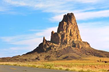
Agathla Peak, Monument Valley is a 1,400 feet (457 meter) peak found south of Monument Valley in Arizona seven miles (11 kilometers) north of Kayenta, Arizona.


